ACCIBERG
Arctic Cross-Copernicus forecast products for sea Ice and iceBERGs
Developing a new iceberg forecasting service and improving the quality of Arctic sea ice forecasts across Copernicus Marine and Climate Change services
ICECAP Prediction of the September sea ice minimum
The existing C3S seasonal predictions of Arctic sea ice concentration only provide monthly means and no regional assessments. For marine users who have to operate in the vicinity of the ice edge, more fine-grained assessments of the forecasts are needed to be useful. This is what ACCIBERG’s ICECAP software has been developed to do, as a contribution to the evolution of the Copernicus Services, in order to bring sea ice forecasts closer to the users.
For this year’s summer minimum, near-average conditions are expected. Forecasts from July onwards have been indicating slightly more favourable conditions in the northern sea route than in recent years, but still no navigation possible after October. The conditions on the Northwest passage route are heavier than in the past years.
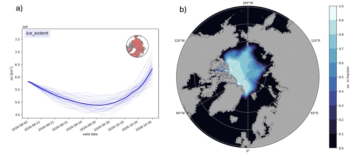
As a demonstration of what is possible using ICECAP, Figure 2 shows the daily evolution of pan-Arctic sea ice extent and a map of the ice cover expected around this year’s annual minimum as predicted by the ECMWF contribution to the C3S multi-model seasonal forecasting system. On the left, we see that the annual minimum is expected around the 20th September, but there is uncertainty about the minimum extent. On the right, we see there seems to be a good chance for the ice to retreat sufficiently in the Laptev and East Siberian Seas to allow shipping. However, there are still heavy ice conditions in the Northwest passage. Users of ICECAP will notice that both the amplitude and the timing of the sea ice minimum change from one model to another, suggesting that there is substantial uncertainty in the forecasts.
The ICECAP software, now runs as a prototype service on the EDITO platform and allows end users to visualize sea ice forecasts from C3S and CMEMS services at the touch of a button.
ICECAP Prediction of the September sea ice minimum
The existing C3S seasonal predictions of Arctic sea ice concentration only provide monthly means and no regional assessments. For marine users who have to operate in the vicinity of the ice edge, more fine-grained assessments of the forecasts are needed to be useful. This is what ACCIBERG’s ICECAP software has been developed to do, as a contribution to the evolution of the Copernicus Services, in order to bring sea ice forecasts closer to the users.
Newsletter No.7 now out
The latest ACCIBERG project news is out! As the project is nearing its end, the services that have been developed are now being tested and used in real life situations. The OpenBerg software is being used to track a huge iceberg off the coast of Greenland, while the ICECAP software can give a more detailed picture of the upcoming September sea ice minimum.
Newsletter No.6 now out
The latest news from ACCIBERG is here - our newsletter number 6 is now out! Find out about our new guides to sea ice and iceberg forecasts on EDITO, the upcoming stakeholder workshop, and how the iceberg GPS tagging has been going.
ACCIBERG Stakeholder Workshop - 12 June 2026
ACCIBERG invite you to the second stakeholder workshop, taking place both online and in person at DMI, Copenhagen, Denmark from 9:00 - 14:00 on 12th June 2026.
Iceberg Tagging Photo Gallery
The field campaigns to deploy GPS trackers onto icebergs have resulted in some fantastic images and videos of icebergs in remote parts of the Greenland coast. Head to the Photo Gallery on the Iceberg Activities page to scroll through the pictures from the campaigns. Many thanks to the SEDNA team and Sagax Entertainment for compiling these.
Juliette helps us produce better forecasts
How do we know what happens over the lifetime of an iceberg? By placing a GPS tag, in this case named Juliette, on an iceberg, we can get a rare glimpse into its journey – and a chance to improve forecasts of iceberg trajectories. That’s important in a warming Arctic, and where shipping and tourism are predicted to increase.
Iceberg Tagging Campaigns
The west coast of Greenland is home to the main iceberg-producing glaciers of the region, where huge icebergs calve directly into the sea. The area between Disko Bay and Melville Bay can produce thousands of icebergs each year, the largest of which are ground in the fjords and never become free.
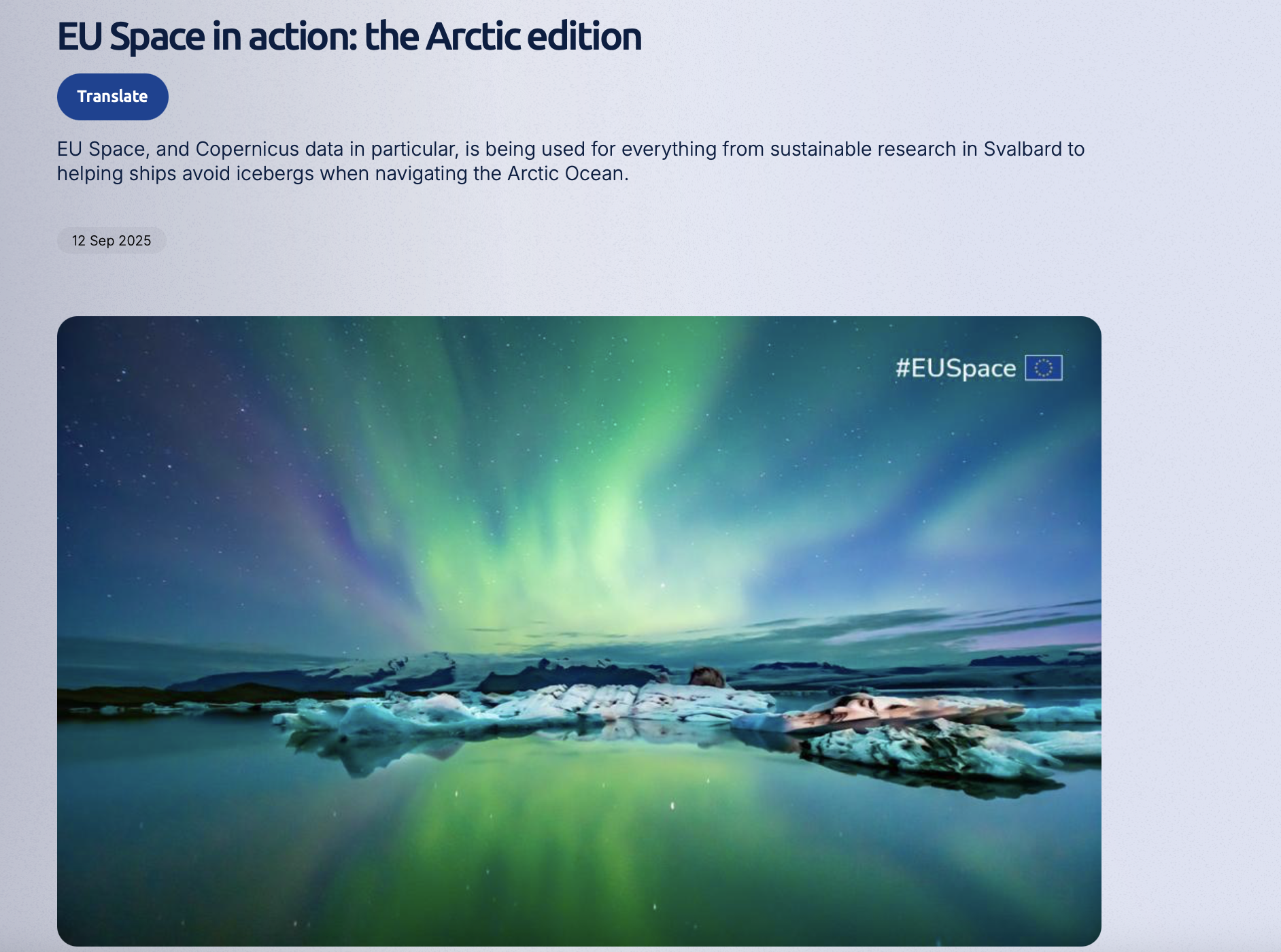
Article: EU Space in action: the Arctic edition
ACCIBERG has been profiled in a magazine article for the EU Agency for the Space Programme (EUSPA).
Newsletter No. 5
The latest ACCIBERG newsletter is now available to download, with reports on the latest project results on the iceberg forecast developments and progress in putting these forecasts on Copernicus’ EDITO Platform and
MetNo’s Værio Platform.
Arctic Cross-Copernicus forecast products for sea Ice and iceBERGs
Led by the Nansen Environmental and Remote Sensing Center (NERSC)
Follow Us
Subscribe to our mailing list

This project has received funding from the European Union's Horizon Europe research and innovation programme under grant agreement No. 101081568